Sub-Rural Fringe Zone
Summary of Dominant Character
This project has described the ‘Sub-Rural Fringe’ as a zone characterised by:
“an open landscape with strong rural indicators such as open space, relict field patterns and boundaries, high levels of woodland and a general absence of housing or active industry…[where]… the influence of nearby or surrounding urban settlement has fundamentally altered their character.” (Sheffield ‘Sub-Rural Fringe’ character zone description).
In Sheffield, a number of areas retaining substantial rural characteristics have been enveloped by urban settlement but preserved as parkland or other open space. The topography of Sheffield has partly influenced the development of this zone around the city, due to large areas where gradients are too steep for large scale urban development; the early activities of philanthropic individuals and groups was another key influence (Sewell 1997, 208-210). In Doncaster borough, this process has been less pronounced, with surburban development enclosing smaller and fewer areas for recreational purposes. The only character area to be defined in this zone comprises the Doncaster Racecourse and land around Danum School and Wheatley golf course to the north and south of Armthorpe Road.
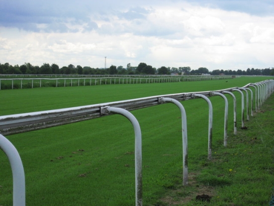
Figure 1: Doncaster Racecourse
Photo © 2007 Oxana Maher and licensed for reuse under a creative commons licence http://creativecommons.org/licenses/by-sa/2.0/
Doncaster Racecourse features a large grandstand and other buildings along its northern edge, with the race track (itself defining the teardrop shaped perimeter of the site) laid down to permanent grass. The area within the track is landscaped as a golf course.
Danum School and Wheatley Hall golf course are typical of many examples of their type nationally.
Relationships with Adjacent Character Zones
This zone is related closely to the suburban landscape that surrounds it, having been retained as open space for its amenity value.
Inherited Character
Accounts of racing in Doncaster tend to attribute a possible 16th century origin, although the first definite documentary evidence dates to 1614, by which time Doncaster Corporation was involved in the upkeep of a course. Early races are recorded as taking place on Cantley and Doncaster Commons, with the present site on Doncaster Common (aka Town Moor) established by the Corporation in 1777, following the enclosure of most of the common land to the east of the town (Boucher and Oakley 2005, para. 7.5). Legibility of the pre-racecourse landscape is invisible, although the placename Town Moor obviously recalls the common land origin. Links between traditional common land and horse racing are widespread nationally – the racecourses of York and Newmarket are other examples where present sites originated as common land.
The northern parts of this character area, around Armthorpe Road, were beginning to move away from their rural origins by the early 20th century, with housing areas to both east and west by 1938. Markham Main Colliery, situated to the south-east, was first sunk in 1916 (Hill 2001, 29). To the west the Wheatley Hall suburb dates to a similar period. Wheatley Hall golf club moved to its present site between 1930 and 1937 (OS 25 inch to the mile maps), clearing all existing internal field boundaries apart from one, which runs north south through the centre of the site. Landscaping of the course does not appear to have fossilised any other earlier features, although Shaw Wood to the north of the site is probably ancient in origin.
Danum School is first depicted on the 1968 OS map and by 1982 it had been extended to the south across the playing fields. Formerly, the area was probably piecemeal enclosure; legibility of this character is no more than fragmentary, but some partial field boundaries have been retained, for instance around the allotment gardens to the east of the school.
Later Characteristics
Current drivers for change in this zone appear to be mainly restricted to the site of Doncaster Racecourse, where major reconstruction works took place during 2006-2007 to rebuild the main stands and betting areas. Further works to develop apartment housing and a hotel on the site were granted planning permission in 2007 and are due to take place from 2008-9.
Character Areas within this Zone
Map link will open in a new window.
- Doncaster Eastern Sub Rural Fringe (Map)
Bibliography
- Boucher, A. and Oakley, N.
- 2005 Doncaster Racecourse, South Yorkshire: Desk Based Assessment [unpublished]. Hereford: Archaeological Investigations Ltd for Doncaster Racecourse Management Company Ltd.
- Hill, A.
- 2002 The South Yorkshire Coalfield: a History and Development. Stroud: Tempus Publishing Ltd.
- Sewell, J.
- 1997 ‘Paradise Lost? Sheffield’s Historic Parks and Gardens’. In: M. Jones (ed.), Aspects of Sheffield 1: Discovering Local History. Barnsley: Wharncliffe Publishing, Ltd.